 |
ArchaeoastronomyEquinox Observations at Atlatl RockValley of Fire State Park, NV, USA |
 |
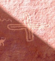
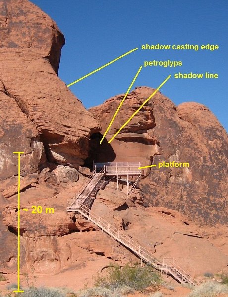
The Atlatl Rock SiteAtlatl Rock is one of the many beautiful sites in the The petroglyphs of interest are on the left (south) side of a straight, smooth rock wall that is almost perfectly facing east with an offset of only about five degrees (azimuth 85 degrees). This archaeoastronomy site is outstanding as it is easily accessible: although the petroglyphs at Atlatl Rock important for this investigation are at an estimated height of about 20 meters above ground level, no climbing on rocks is necessary. Not even the 84 steps of the stairs leading to the observation platform have to be climbed, as the petroglyphs including the markers and the shadow are visible from the level of the parking lot. The facilities of the State Park Visitor Center are not far away. There are many more petroglyphs in the vicinity of Atlatl Rock which have been engraved mostly in rocks covered with deep black desert varnish. Atlatl Rock however is almost red! These petroglyphs are estimated to be more than 4000 years old! Respect their antiquity. Help preserve them! Do not climb on, touch or deface the rock. Atlatl Rock Coordinates:
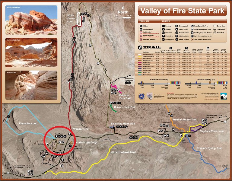
Coordinates used in Valey of Fire State Park Map:
Aerial photograph of the Valley of Fire and the Atlatl Rock area:
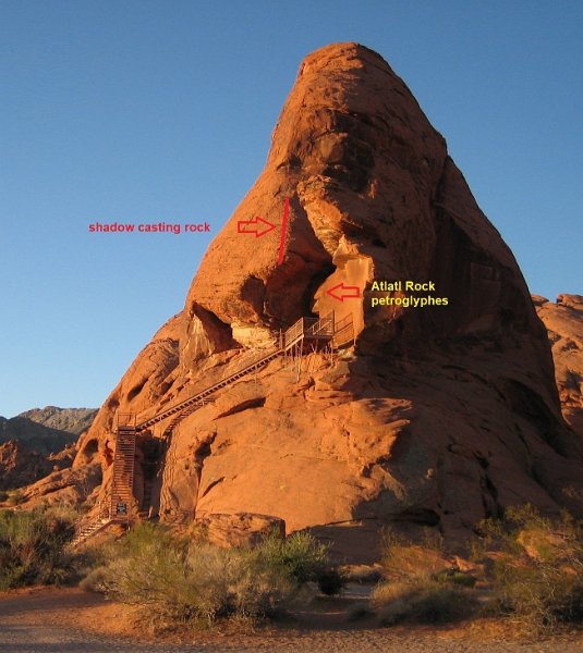
Atlatl Rock as seen from east:  June 24, 2011; ~7:00 am PDT, ~30 minutes after sunrise; location of the petroglyps indicated; view from main road (VoF Hwy 169); (click on the pictures twice to see full resolution!) Atlatl Rock as seen from north-northeast:  September 21, 2010; ~7:00 am PDT, ~30 minutes after sunrise; location of the petroglyps indicated; (click on the pictures twice to see full resolution!)
The site of the Atlatl petroglyps:
Panoramic view from the platform at Atlatl Rock from north (left) to south (right) looking towards east (center):  (June 24, 2011; ~11:45 am PDT; click twice on the picture for full resolution) Sunrise locations: |
|||||||||||||||||||||||||||||||||
by Helmut Steinle


